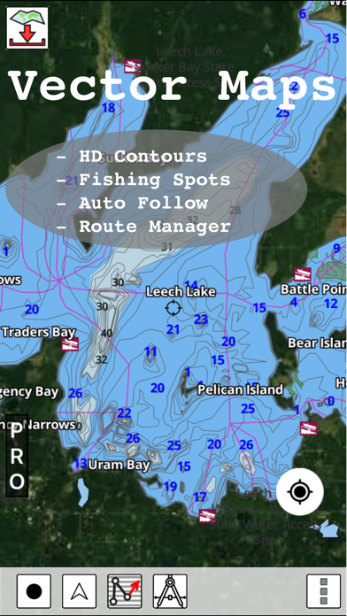
WindowsDen the one-stop for Travel Pc apps presents you Europe Rivers Canals/Waterways by Bist LLC -- Europe Inland Rivers/Waterways Navigation / Charts App offers access to nautical charts covering major rivers, canals and waterways in Europe - Danube/Donau/Dunaja, Sava, Drava, Rhein, Ruhr, Saar, Sulina, Mosel/Moselle, Elbe, Dijle, Zeekanal etc. All charts include POI data. It supports Marine Charts course up orientation. It has route manager to create new boating routes or import existing GPX/KML routes.
Only marine navigation app to have route assistance with Voice Prompts for marine navigation.
* Voice Prompts for marine navigation / nautical naviagtion (requires GPS )
-prompts when approaching a boating route marker
-Continous distance and ETA updates
-Alerts when sailing/boating off route
-Alerts when boating in wrong direction
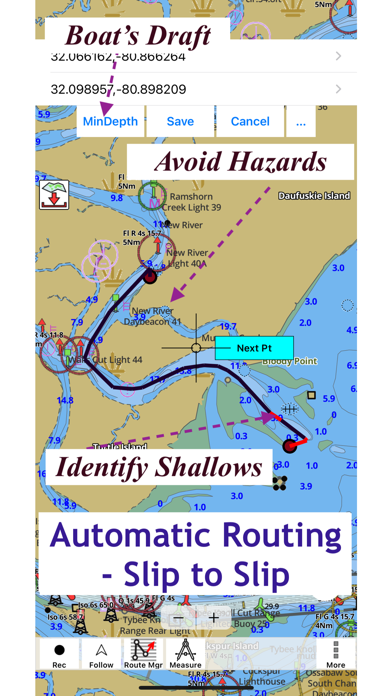
►SLIP TO SLIP AUTO ROUTING
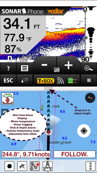
►Instrumentation
√ Marine AIS & (NMEA AIS and GPS over TCP/UDP)
√ Wind direction & Speed,Marine Sonar depth,Water temperature
*** For any question, contact support at gpsnauticalcharts.. We hope you enjoyed learning about Europe Rivers Canals/Waterways. Download it today for £23.99. It's only 56.70 MB. Follow our tutorials below to get Europe Rivers Canals Waterways version 122.0.0 working on Windows 10 and 11.

 Waterducts
 Capitals of Europe