Download i-Boating: Malta Marine Charts for PC
Published by Bist LLC
- License: £19.99
- Category: Navigation
- Last Updated: 2018-05-17
- File size: 49.90 MB
- Compatibility: Requires Windows XP, Vista, 7, 8, Windows 10 and Windows 11
Download ⇩
Published by Bist LLC
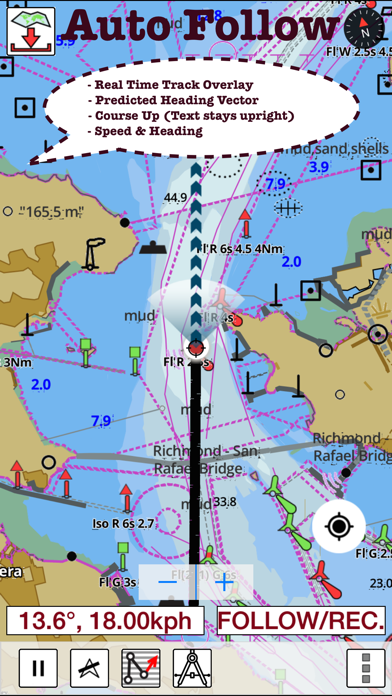
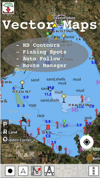
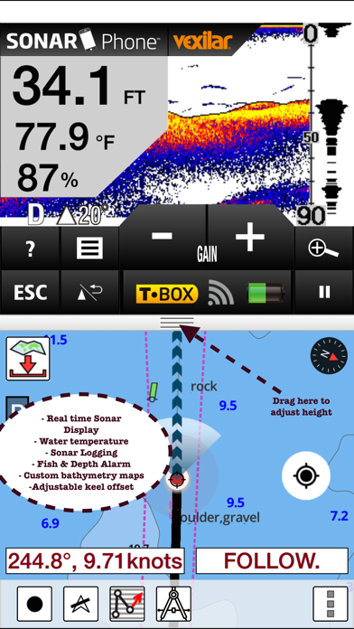
WindowsDen the one-stop for Navigation Pc apps presents you i-Boating: Malta Marine Charts by Bist LLC -- GPS Marine Charts App offers access to charts covering Malta waters (derived from MMA(Malta Maritime Authority) data). Only marine GPS app to have route assistance with Voice Prompts for marine navigation. It has route manager to create new boating routes or import existing GPX/KML routes. It supports Nautical Charts course up orientation. Please visit http://www. gpsnauticalcharts.. We hope you enjoyed learning about i-Boating: Malta Marine Charts. Download it today for £19.99. It's only 49.90 MB. Follow our tutorials below to get i Boating version 71.0.0 working on Windows 10 and 11.
| SN. | App | Download | Developer |
|---|---|---|---|
| 1. |
 i-Boating:Marine
Navigation Maps & Nautical Charts |
Download ↲ | Bist LLC |
| 2. |
i-Boating : Marine Navigation Charts & Lake Maps GPS |
Download ↲ | Bist LLC |
| 3. |
i-Boating: Australia GPS Nautical Charts |
Download ↲ | Bist LLC |
| 4. |
i-Boating: USA - GPS Nautical Charts |
Download ↲ | Bist LLC |
| 5. |
i-Boating: WMTS - Marine & Lakes |
Download ↲ | Bist LLC |
OR
Alternatively, download i-Boating APK for PC (Emulator) below:
| Download | Developer | Rating | Reviews |
|---|---|---|---|
|
i-Boating:Marine Navigation Download Apk for PC ↲ |
Gps Nautical Charts | 4.7 | 11,315 |
|
i-Boating:Marine Navigation GET ↲ |
Gps Nautical Charts | 4.7 | 11,315 |
|
Navionics® Boating
GET ↲ |
Garmin Italy Technologies srl |
3.8 | 38,842 |
|
Marine Ways - Nautical Charts GET ↲ |
Kernalite | 4.5 | 2,066 |
|
C-MAP - Marine Charts
GET ↲ |
Navico Norway AS | 3.9 | 11,318 |
|
Wavve Boating: Easy Marine GPS GET ↲ |
Wavve Boating | 4.4 | 861 |
Follow Tutorial below to use i-Boating APK on PC: