WindowsDen the one-stop for Reference Pc apps presents you Tidal Stream Atlas North Sea, South by Martijn de Meulder -- All sea maps from the Tidal Stream Atlas for the North Sea, Southern Portion.
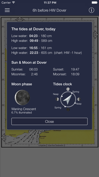
+ Today's tide times for the reference station of these maps: Dover, including spring and neap tidal data, current moon data, sunrise and sunset.
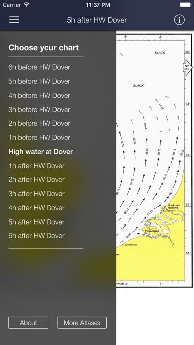
The charts show both direction and rate of tidal streams at hourly intervals by careful and accurate use of graded arrows and display mean neap and spring tidal rates in tenths of a knot. The app also shows you today's tides at Dover, for which an internet connection is required.
This app is universally available on both your iPhone and iPad. The sea maps are zoomable, thus also of good use on the smaller phone screen.. We hope you enjoyed learning about Tidal Stream Atlas North Sea, South. Download it today for £4.99. It's only 71.00 MB. Follow our tutorials below to get Tidal Stream Atlas North Sea South version 2.3 working on Windows 10 and 11.


 Irish Tides
 Atlantica