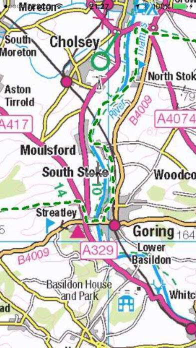
WindowsDen the one-stop for Navigation Pc apps presents you Ridgeway Trail by Paul Johnson -- The map shows the entire route of the Ridgeway National Trail in various scales using OS maps overlaid with the very latest Open Street Map (OSM) data, 10m contours, and a 1km grid, making it an invaluable walking companion.
The path is highlighted in thick green dashed lines. Other footpaths (not necessarily public rights of way) are shown in narrow green dashed lines.
The area within 5km of the path is shown in detail overlaid with OSM data including street names, pubs, restaurants, hotels, shops, toilets, ATMs, Post Offices, and points of interest. Many of these are labelled.
The region outside the 5km is shown in less detail but can still be used as an offline map of the surrounding area.. We hope you enjoyed learning about Ridgeway Trail. Download it today for £3.99. It's only 249.07 MB. Follow our tutorials below to get Ridgeway Trail version 1.0 working on Windows 10 and 11.


 The Trail West
 The Oregon Trail
 Rambling Pathways